
Middletown Neighbors by Block Source
A Middletown block can be researched through parcel and civic records, each with a narrow purpose. GIS locates the land. Parcel Information and the annual roll identify an assessed owner, situs, mailing field, and tax-map number for a given year. The County Clerk preserves recorded transfer records. Ward materials place a street in civic geography. Historical directories and newspaper collections can add a dated street context. None creates a reliable present-day roster of everyone near an address.
| Source | What It Shows About a Block | Access |
|---|---|---|
| Orange County GIS buffer | Parcel polygons, streets, map layers, buffered area, and parcel identifiers | Search, Zoom, Buffer, and record map date |
| County Parcel Information | Assessed owner, situs, mailing field, assessment, tax map, and municipality | County property search |
| Annual assessment roll | Adjoining entries, owner, class, dimensions, school district, SBL, and deed bridge | Year-specific assessment record |
| Orange County Clerk | Recorded parties, legal description, book or instrument reference, and transfer date | Record Room or online index |
| Ward-by-street maps | Street and ward assignment for civic geography | City maps |
| Thrall directories and newspapers | Historical street, business, or occupant context for a stated year | Thrall Local History |
Owner is not the same as occupant. A mailing address can be elsewhere, and the parcel may be vacant, commercial, institutional, tax-exempt, or divided into units. Treat the mapping result as adjacent tax parcels, not a personal-neighbor list. That language keeps the record’s land purpose clear and avoids turning a useful map tool into a claim about a household.
Map a Middletown Block With GIS Buffer
Orange County GIS is the official adjacency route. Its parcel search accepts owner name, address, or parcel ID and supports partial strings. Choose the municipality when it is known, or use the address locator with address, city, state, and ZIP. After finding the anchor parcel, use the result-table Zoom action, set a buffer distance and unit, then inspect the parcels whose polygons fall inside the buffer. Capture the displayed map date and layer with the result.
Use the official GIS result-table and Buffer help before applying the tool to an address.
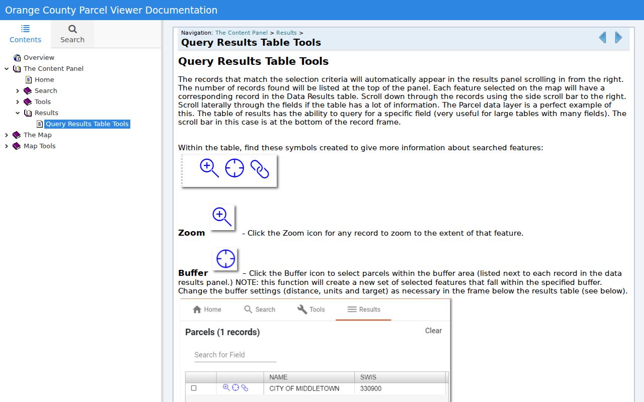
The Buffer action finds nearby tax parcels for map research. It does not verify a survey boundary, title, or who is physically present at any address.
- Search the anchor address or SBL, then confirm the selected municipality and physical situs.
- Use Zoom to inspect the selected parcel and set a measured buffer distance with the desired unit.
- List each parcel identifier inside the buffer separately, with the map date and map layer used.
- Cross-check only the needed parcels against the annual assessment roll for the relevant year.
- Use the deed book, page, or instrument reference for a dated title question, not for a present-occupancy claim.
This is a process flow: address or SBL → GIS parcel → Buffer → adjacent tax parcels → assessment-year fields → County Clerk instrument. When the question expands from an immediate radius to an entire named street, the Middletown street directory route is the better record trail.
Middletown Neighbors Need Parcel Terms
An SBL is the section, block, and lot reference used to identify a parcel in local assessment work. The situs is the physical property location. A mailing address is where an owner receives mail, and it may differ from the situs. The City Assessor’s address-change form includes separate property location, owner, old mailing address, new mailing address, and section/block/lot fields. That separation is direct evidence that mailing information must not be silently converted into a residence claim.
- Adjacent tax parcel
- A parcel that falls next to or within a selected GIS buffer area, not proof of a personal neighbor relationship.
- SBL or tax map number
- The local parcel identifier used to cross-check the map, assessment record, and deed trail.
- Situs address
- The physical property location shown in the assessment or parcel record.
- Mailing address
- An owner correspondence field that can be different from the property location.
GIS geometry is also not a legal survey. It is a research aid. The recorded instrument and, when necessary, a qualified survey control questions about legal boundaries. Keeping the source label attached to each field makes the result easier to repeat and less likely to overstate what the map says.
Middletown Block Records Have Dates
Orange County Parcel Information advertises searches by owner name, address, tax-map number, and municipality. Its reports can show owner, parcel, assessment, tax-map, photo, comparable-search, and related property information. The City Assessor is a separate office that handles assessments, exemptions, transfers, subdivisions, and lot-line work. Compare the parcel record with the assessment roll for the correct year before treating a field as current. A roll is a dated tax record, not a deed image and not proof of occupancy.
The County Clerk supplies the recorded instrument layer. The county’s online information lists land records from 1978 forward, with earlier scanning underway, while the SearchIQS availability material describes land data back to 1953. Those dates are not interchangeable. If the date matters, ask the Record Room whether the needed period is available as an index, image, historic book, or copy. Historical grantor/grantee index books cover 1910 through 1977, and a name in that index still needs confirmation against the image or clerk copy.
Note: Preserve the roll year, SBL, record type, and instrument reference together, because a similar street address may not identify the same parcel over time.
Middletown Neighbors and Ward Context
Ward-by-street maps and voting locations describe civic geography. They can explain which ward includes a street and help check whether a city address has been placed in the right municipal context. They cannot show who lives at an address. Election locations change with election administration, and a polling location is not household evidence. Use the current city map for ward context and the Board of Elections for official election information.
New York Election Law permits supervised public registration records and election-district lists under stated rules, while protecting driver-license, DMV, Social Security, and facsimile data. NYS VoterLookUp is a current individual registration and poll-site tool, not a downloadable block list. Confidential registration under Election Law section 5-508 is held separately. Do not use ward or poll-site geography to infer a confidential voter’s location.
Middletown Community Organizations Without Rosters
Community resources can explain a block’s civic context without compiling private participants. The City of Middletown Organizations page lists civic groups such as Kiwanis, Lions, and Rotary. City staff material identifies Neighborhood Watch as a public safety and community contact. The Downtown Business Improvement District, established in 1991, is a special-assessment district tied to downtown civic and economic activity. It is not a resident association. Research found no official citywide neighborhood-association or HOA umbrella directory, no public member roster, and no public block-captain list.
Use the City of Middletown Organizations source for public community context and contact routes.
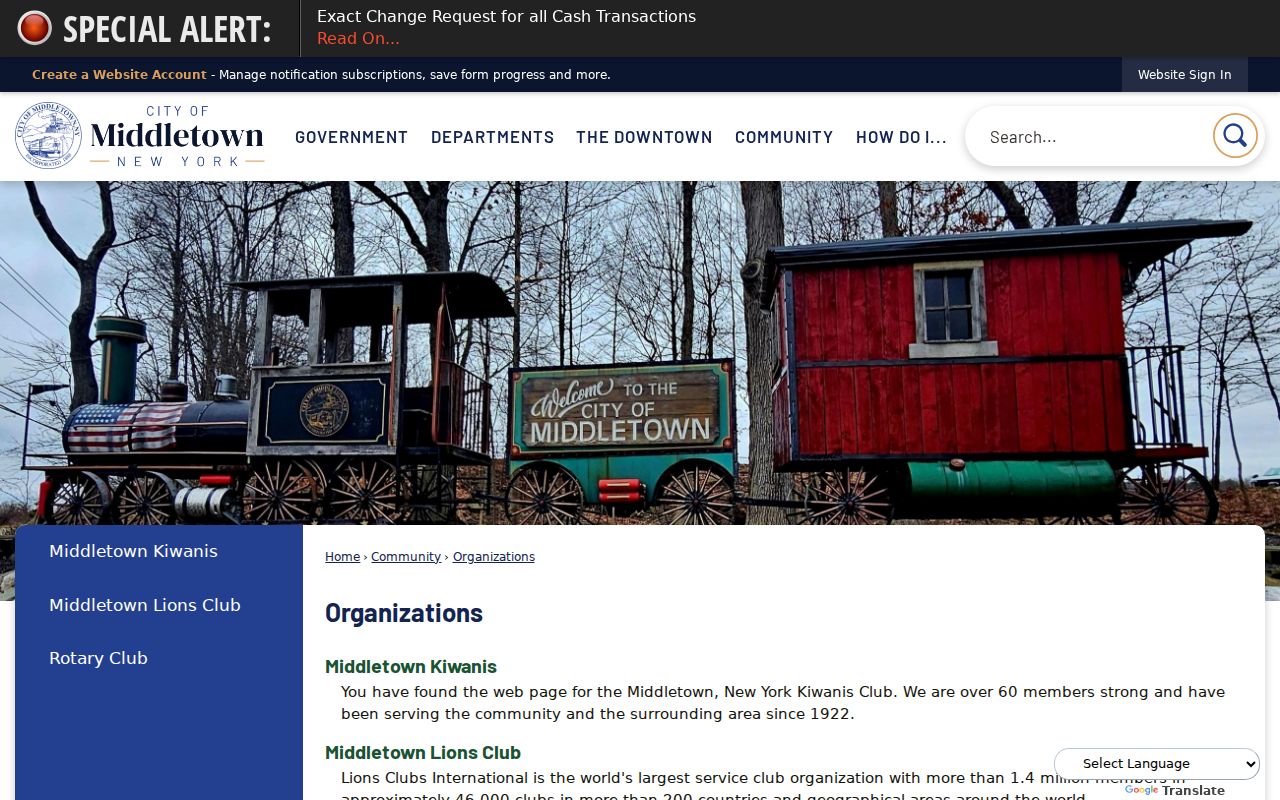
The organizations page supports a civic-context search, while member identity and private contact details remain outside the public record method.
| Resource | Useful public context | Do not infer |
|---|---|---|
| City Organizations | Links and history for civic groups | Membership or a household address |
| Neighborhood Watch | Public safety and community contact route | Block-captain names or participant list |
| Downtown BID | Downtown district and civic activity since 1991 | A resident group or resident roster |
| City Clerk, Planning, or library | Public-facing association lead, if one exists | Authority to create a private participant list |
Middletown Block History Uses Dated Sources
For a historic block question, build the parcel trail first and then pair it with dated local material. Thrall’s microfilm holdings include Middletown city directories from 1871 through 1984, and the digitized Middletown directory covers 1857 through 1858. Newspapers, obituaries, photo captions, and historic maps may add a street or business reference. Preserve the year, page, reel, publication, caption, and access date. A historical entry can describe a past occupant, owner, shop, or event. It does not establish present circumstances.
Address changes need extra care. “South Middletown” was a historical name from 1829 through 1849, and old Minisink Road corresponds to today’s East and West Main Street corridor. Search historical aliases without overwriting the original address. When a number conflicts, compare the map, legal description, and parcel rather than guessing. This record trail is useful for local history while keeping private people out of a current block list.
Middletown Neighbor Sources Compared
Official records and commercial neighbor-search categories answer different questions. The official route exposes the record’s custodian, date, source field, and correction path. It also carries access limits and redactions. A commercial category can blend old addresses, unrelated names, or unknown sources. For a block question, the accountable method is slower but allows each field to be tested against a parcel, assessment year, or recorded instrument.
| Method | Strength | Limit |
|---|---|---|
| Official parcel, GIS, roll, and deed sources | Named custodian, dated field, and source-specific correction route | Shows property or record relation, not a full household |
| Commercial neighbor-search category | May offer a quick lead | Can mix dates, sources, and same-name people without clear verification |
| Historical directory or newspaper | Adds dated street context | Historical, incomplete, and not current evidence |
For any serious question, retain the map source, assessment year, Clerk reference, and the reason the individual fields were connected. That small evidence trail is more useful than an unverified list of names.
Middletown Neighbor Privacy Limits
Privacy rules matter most at the block level. Do not publish unit-level names, private phone numbers, children’s details, victim or ACP addresses, protected court addresses, or a map designed to make a vulnerable person easy to locate. New York’s Address Confidentiality Program provides a substitute mailing address for eligible participants. Government agencies must generally accept it, and the actual address must not be exposed. The confidential voter route also separates protected records from ordinary public materials.
When a result is old, label it as historical with the record date. When it is a mailing field, call it a mailing field. When an ownership link is all that exists, describe ownership rather than a person’s presence. These limits make a Middletown neighbors search more accurate as well as safer.
Lawful use. Use block records for lawful personal research, property history, civic context, or an estate question. Never use maps, parcels, or record trails to stalk, harass, intimidate, or expose a protected person.